
IRRIOT Launches New “Maps” Feature for Enhanced Irrigation Monitoring and Control
Stockholm, Sweden – January 2025
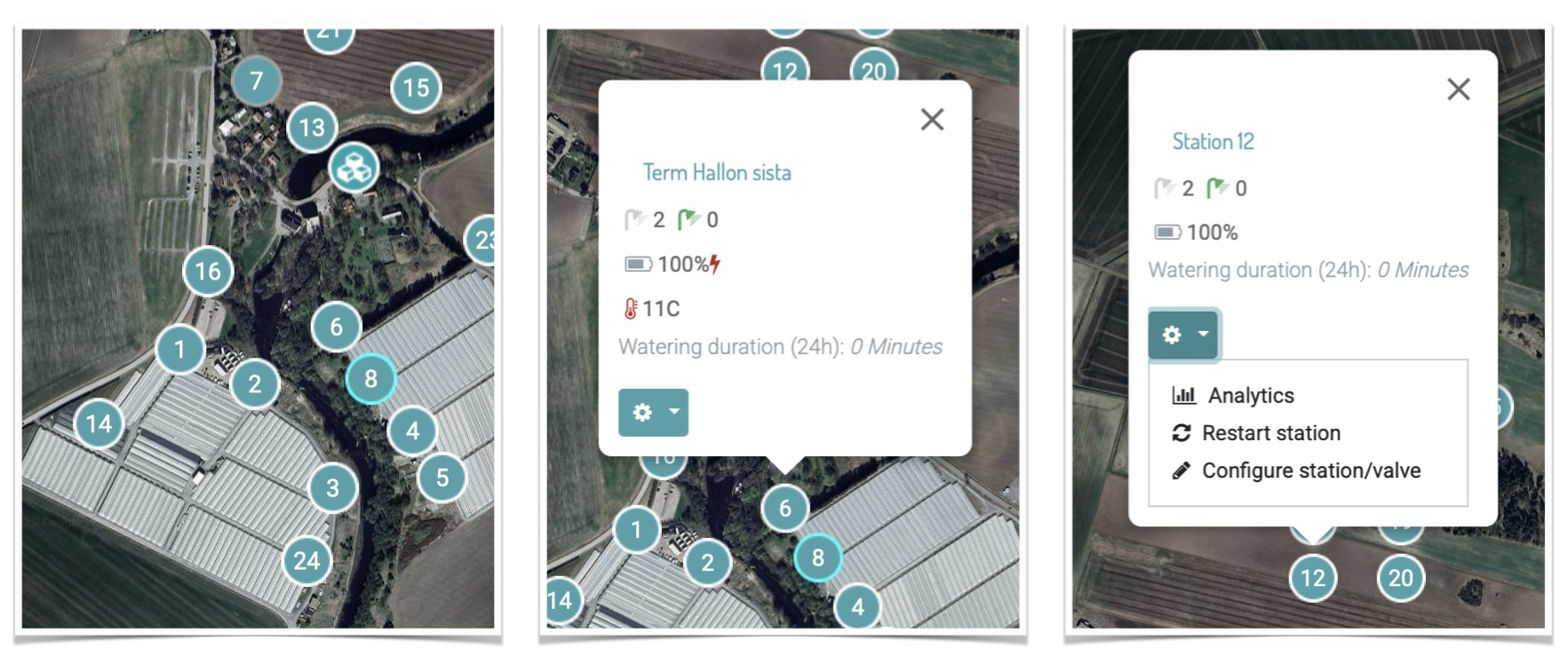
IRRIOT, one of the leaders in wireless precision irrigation solutions, is proud to introduce “Maps,” an innovative feature that transforms the way users visualize and manage their irrigation systems. This useful addition provides a detailed and interactive overview of irrigation operations, streamlining monitoring and control processes for users.
With Maps, users can:
- Graphically Visualize Status: Instantly view alarm and irrigation statuses, ensuring rapid identification and resolution of issues.
- Quickly Access Manual Controls: Directly control valves in real-time via the map interface for precise adjustments.
- Easily Access Analytics: Explore performance metrics and trends to optimize water usage and enhance efficiency.
- Monitor Connected Sensors: Seamlessly track data from soil moisture, temperature, and other connected sensors.
The IRRIOT Map clearly displays the placement of the Base Unit and wireless stations, enabling users to effortlessly monitor all critical components of their irrigation systems. This feature reaffirms IRRIOT’s dedication to delivering smart, sustainable, and user-friendly solutions for agriculture and green spaces.
“Maps redefines the way users interact with their irrigation systems” says Mikhail Soloviev, CTO of IRRIOT. “By combining intuitive visualization with robust controls and analytics, we’re empowering our customers to make informed decisions with confidence.”
The Maps feature is now available on both mobile and web platforms for all IRRIOT users. For more please contact our team.
